Day 4 [Georgia] Mile 27.8 - Mile 38.3: Woods Hole Shelter - Hogpen Gap
Date: February 16, 2025 (Sunday)
Total Distance: 10.5 miles
Mile 28.9 Bloom Mountain Shelter
When the bad weather quiet down around 10AM, we started our climb. I thought the trail would be too wet and muddy to march on, and some section of road might get flooded. Surprisingly the soil absorbed the heavy rain like a sponge and the road was not too hard except the rocks were a little slippery when wet. When we climbed higher and higher, we started to have better views from the tree tops. Passing the Slaughter Creek Trail on our way to the summit.
We day hiked to Blood Mountain before when kids were in elementary school. We took a family photo on the steps of the shelter then. And here we are again, about 7 years later. Andrew has doubled the height from then. Blood Mountain is the most-visited spot on AT southe of Clingmans Dome.
The stone shelter at the summit has two rooms, no door and no glasses on any of the windows. Please also know that there no firewood or water near the shelter, and fires are prohibited in the shelter. A hiker we met at the Gooch Gap mentioned that she had a bad experience camping here Thursday night, as it was windy (typical for high altitude), and mice were rampant, though she watched a very nice sunset. Fresh ground suggested no body stays in this shelter overnight, and mentioned the shelter used to have really bad rats problem for a while.
Crossing the shelter, we came to several flat rock surfaces on descending. The scenery was spectacular.
I would not recommend anyone to hike Blood Mountain in the dark. Luckily we bailed out from that idea last night. Near mountain top, due to lack of trees, the white blaze were mark on the surface of the rocks. Sometime we had to search hard even under the bright sunlight. Imagine how difficult it would be in the dark. Lost in the mountain is no fun, as temperature can drop quickly and wind can pick up at night. Hypothermia would be a big threat in that situation.
Mile 30.4 Balance Rock
After descending, and before reaching Neel Gap, we saw this weird rock that is on top of the other rock, right next to the trail. Later realized that this must be the site for the ‘Balance Rock’. A nature’s wond
Mile 31.3 Neel Gap
It is a mountain crossing (US-19/129) with the only building on AT that the trail actually passed though. The state of Georgia owns the building (Walasi-Yi) and surrounding land and leases it to conessionaries. It has an inn, hostel, a public restroom, and an outfitter.
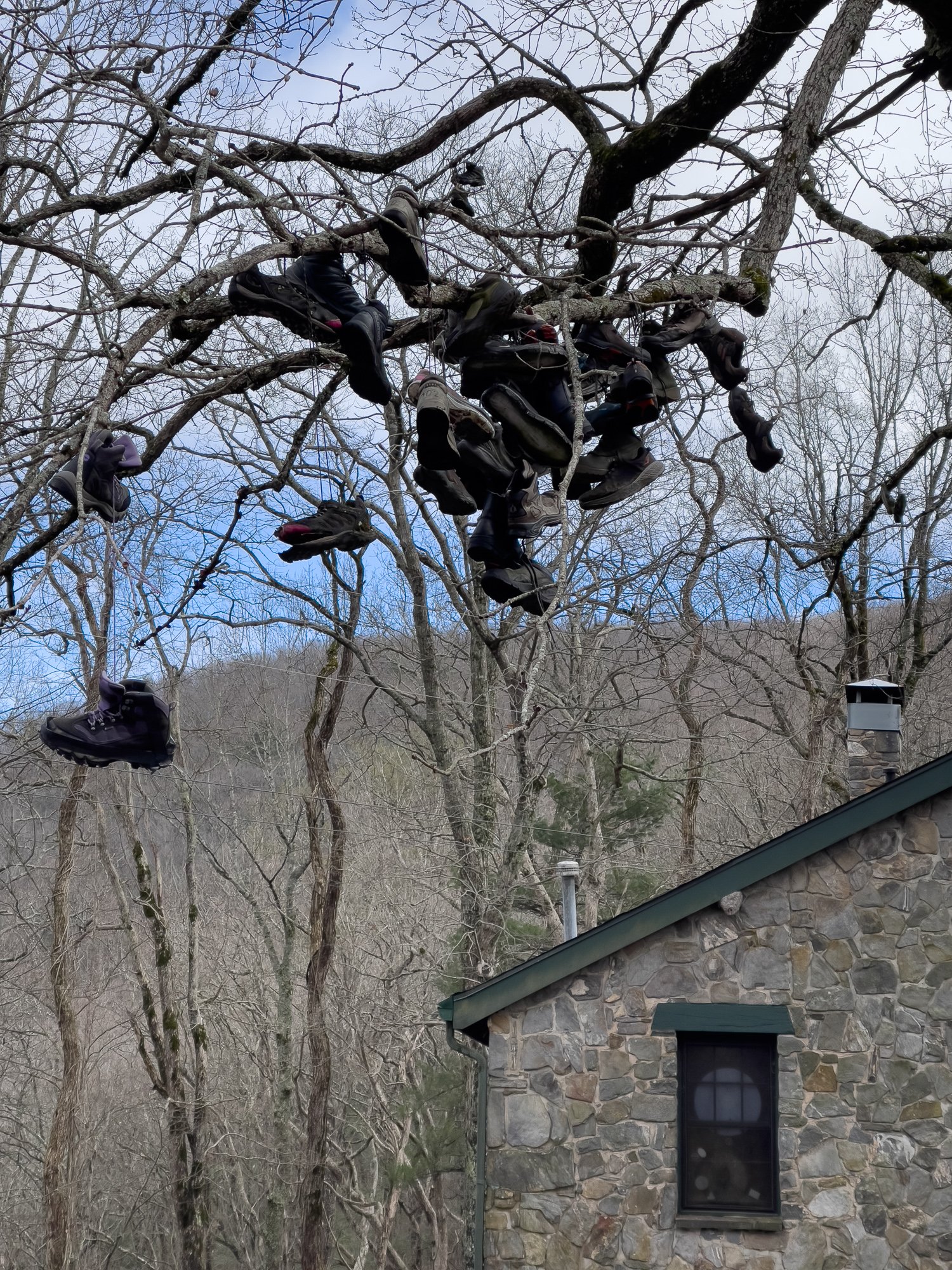
The first thing you will notice after crossing the road from the trail is the sneakers on the big tree right next to the breezeway of the building. According to internet, these were from hikers who celebrate their completion of the trail. However, this is not the destination of either SOBO or NOBO hikers. Maybe these are from the hikers who switched out their broken or unfit boots?
It is 19.0 milestone Cleveland, GA, 14.0 miles to Blairsville, GA, 22.0 miles to Dahlonega, GA, and 3.0 miles to Vogel State Park. Cabins and a store are 0.3 miles east.
The outfitter store there is surprisingly well stocked with a rich variety of hiker gears, at prices that are comparable to online stores. We bought a pizza at the outfitter store. The staff heated it up in microwave, and we finished it in no time at the bench outside. Passing the covered walkway on the west side, we continued our hike to Levelland Mountain.
Mile 37.3 Testnatee Gap
This is another Gap that corss the paved road - GA-348, with a large parking area. However, seems to be a nice picking up/dropping off site, it doesn’t have any amenities/facilities like Neel Gap.
Mile 38.3 Hogpen Gap
It is only about a mile from Testnatee Gap, however, it was a steep ascend. Prior to the peak, there is a view from an open tree tops. Shortly after the peak, there is a sign to the Whitley Gap Shelter, which was suggested by Ron not to go to. It is a 1.2 mile hike to the shelter, and another half mile hike to the spring nearby. But Far Out app suggests that there are fine views along the way. So it is your decision.
Another shuttle driver Grace picked us up on time, and drove us to the Unicoi Gap where we parked our car. That was an aggressive goal, and we felt short due to bad weather and underestimation of the impact of a 20+ pound backpack to our distance. This section hike is very educational: gave us a great chance to learn our nature, and how to plan our hike better. Since then, I bought the AT maps and guidebooks, as well as a few hiking guide books and outdoor survival manual. They have been tremendously helpful. As a section hiker, we do not have the intelligence among the through hiker community. So the AT official guide and companion book would serve as a major source of info to prepare for our future section hike trips.


