Map - Rinconada Canyon
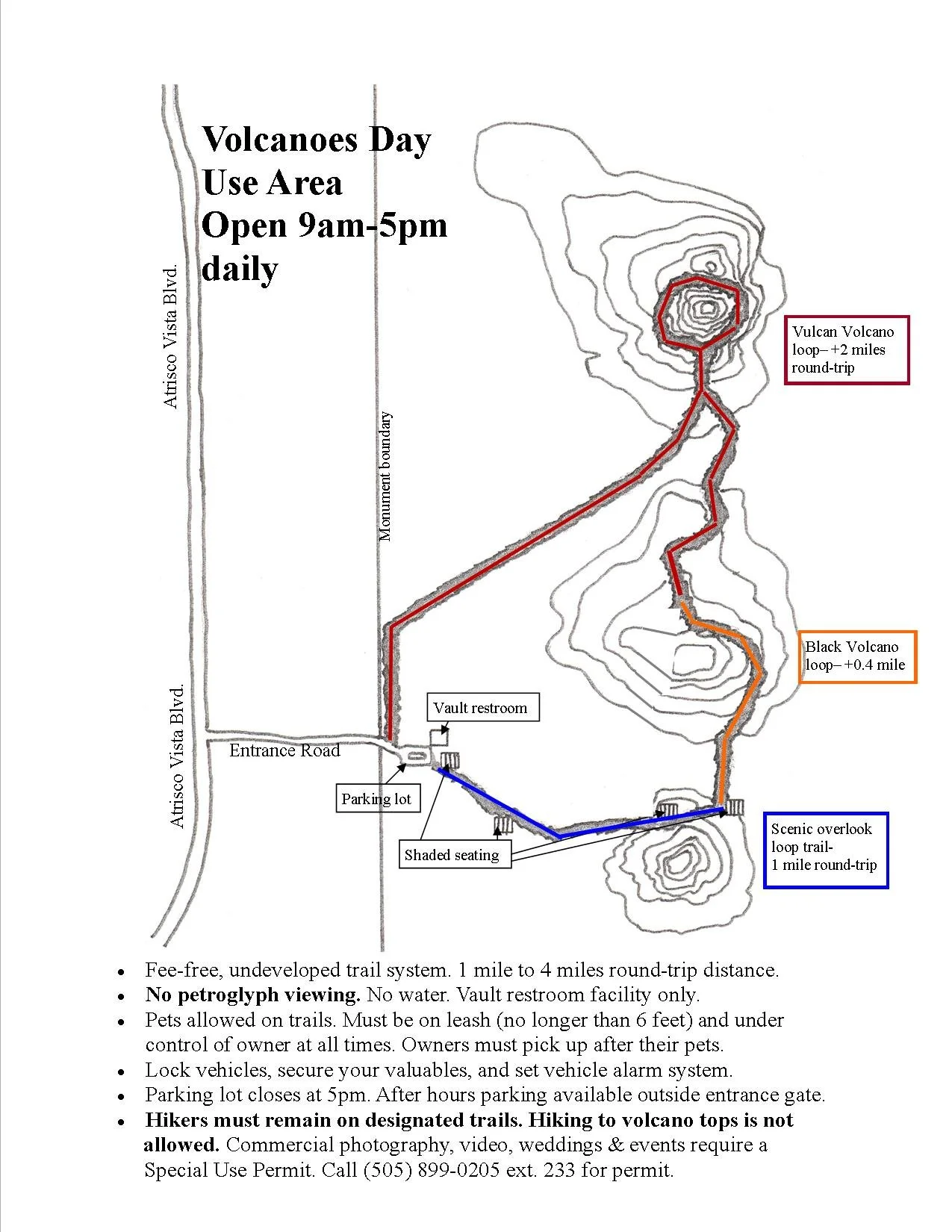
Map - Volcanoes Day Use Area
State: New Mexico
Most known for:
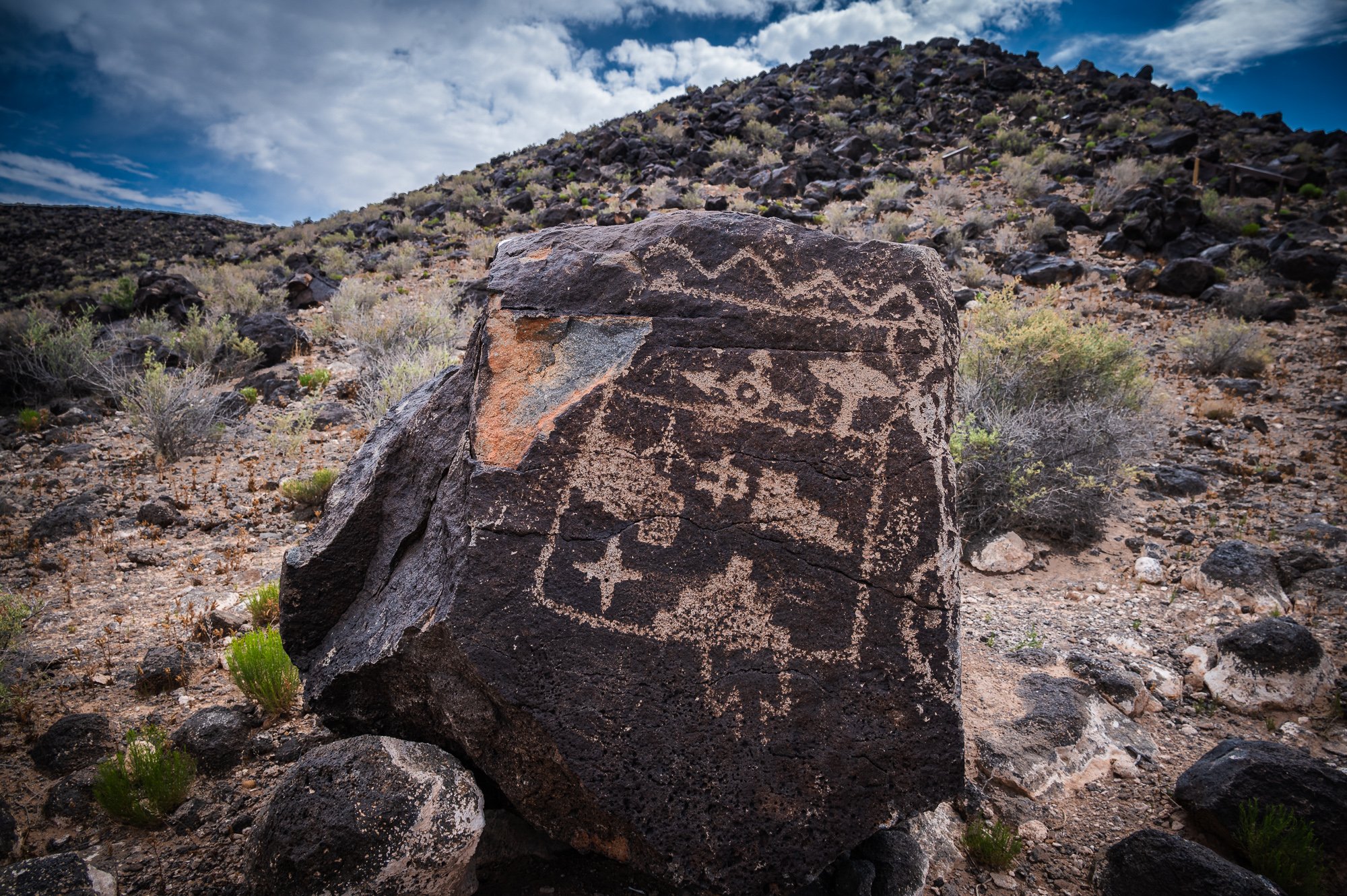
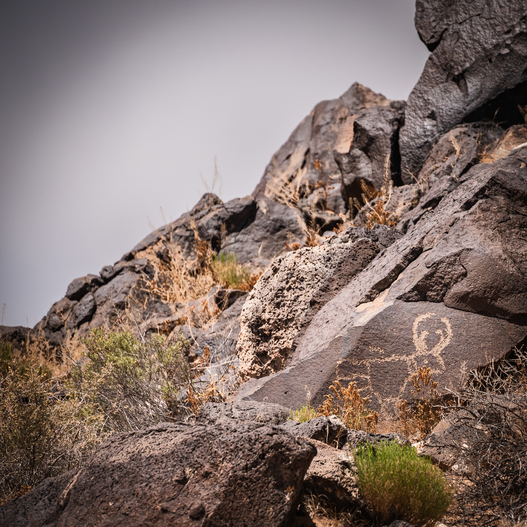
One of the largest petrogplyph in North America, featuring designs and symbols carved onto volcanic rocks by Native Americans and Spanish settlers 400 to 700 years ago. These images are a valuable record of cultural expression and hold profound spiritual significance for contemporary Native Americans and for the descendants of the early Spanish settlers.
Basic Info:
The park stretches 17 miles along Albuquerque’s West Mesa, a Volcanic basalt escarpment. Approximately 200,000 years ago, six volcanic eruptions created a 17-mile-long cliff containing thick basalt layers of rock and cooled lava. The basalt rocks tumbled down to the escarpment’s edge, later eventually cracked and formed canyons and escarpments. The rock contain high concentration of iron, manganese and calcium, combination of which creates rocks of a gray-like color. Over thousands of years of exposure to the desert’s rough environment, a “desert varnish” forms due to the oxidization of the manganese and iron when mixed with oxygen in the air and water from rain. This varnish is dark and glossy in appearance. Native Americans and Spanish settlers discovered that images can be created on the surface of the rocks by chipping away at this layer using rocks and other tools.
Petroglyph National Monument protects five volcanic cones, hundreds of archeological sites, and an estimated 24,000 petroglyph images carved by Ancestral Pueblo peoples and early Spanish settlers. Many of the images are recognized as animals, people, brands and crosses; others are more complex. The monument was authorized on June 27, 1990, and is managed by the National Park Service and the City of Albuquerque.
Reference: NPS, Wikipedia
Plan your visit:
The information center is located 1 - 6 miles away from the petroglyph viewing area. The monument has four major sites that visitors can access:
Boca Negra Canyon: 1 hour, 100 petroglyphs along 3 paved trails that are guided by signs.
Rinconada Canyon: 2 hours, 2.2 miles round trip, 200-300 petroglyphs, moderated undeveloped trail system, moderately strenuous, no water
Piedras Marcadas Canyon: 1.5 hours, 1.5 miles round trip, 300-500 petroglyphs, undeveloped trails, easy to moderate, no water, no restrooms
Volcano Day Use Trails: 1-4 hours, 1-4 miles round trip, no petroglyphs, undeveloped trail system, no water, offers scenic hiking around the volcanic cinder cones, clear view of Rio Grande Vally, and the Sandia Mountains.
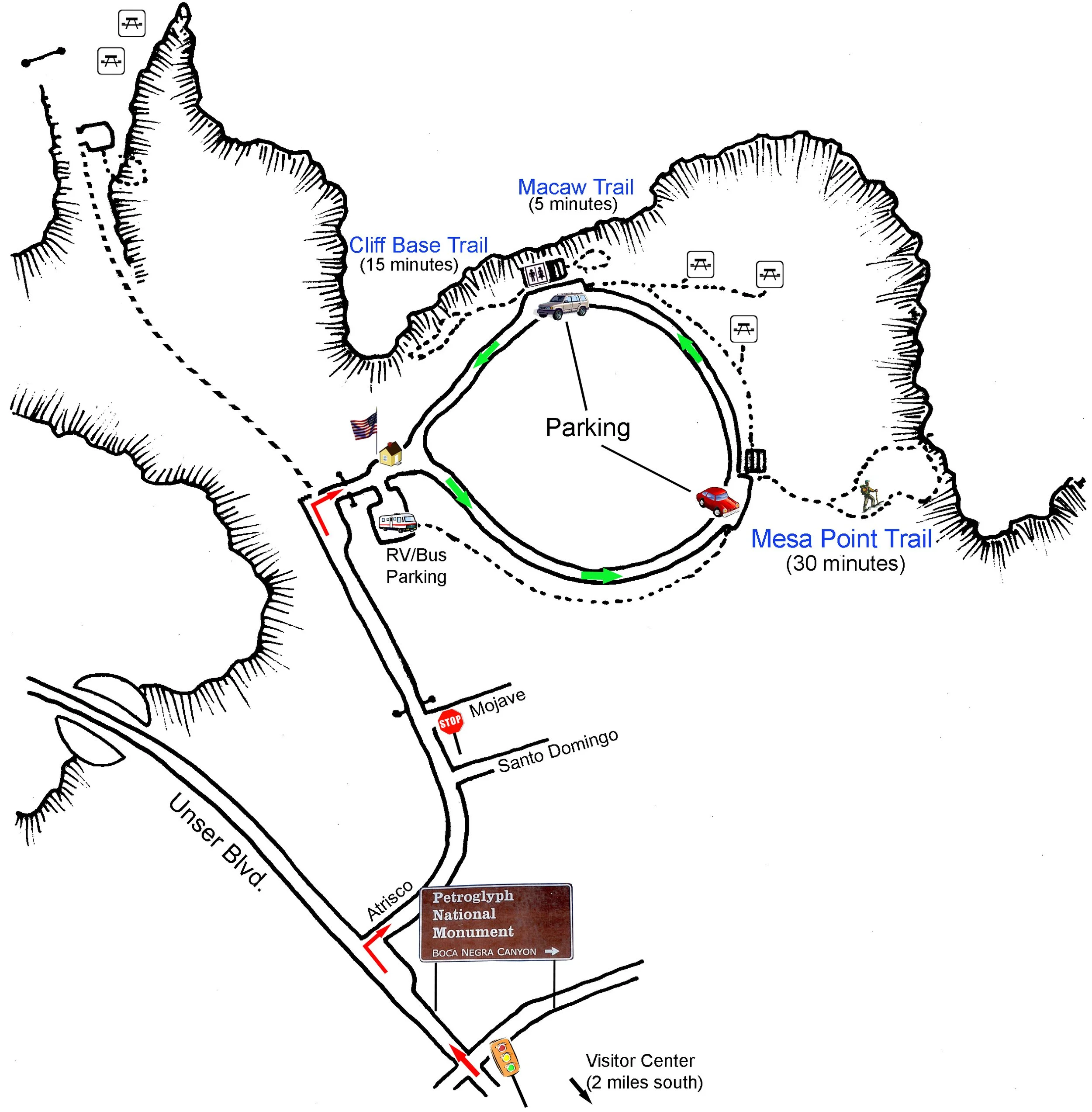
Map - Boca Negra Canyon
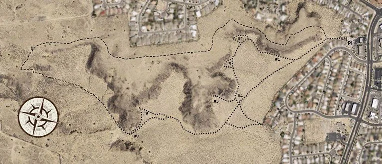
Map - Piedras Marcadas Canyon
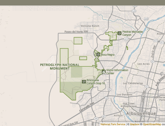
Park Map (NPS)
Metroglyph National Monument, New Mexico
Our Visit
Date: June 2, 2023
This is our first stop of the day trip. We came to the visitor center first, and watched a movie about the park’s geological formation and cultural history. The visitor center has an information desk and a gift shop, but doesn’t have a theater. So we just sit under a tent in the yard and finished watching the movie, nonetheless the movie was very informative.
Due to our time limit, we only visit Boca Negra Canyon, as it is the closes to the visit center, then Piedras Marcadas Canyon, which probably more “cost-efficient” than the Rinconada Canyon based on its density of the petroglyph per mile hiked. For you to consider if you like us do not have enough time to make to both Canyons, but I could be wrong. Boca Negra Canyon is a big mount but not a difficult to climb following the well marked signs. There is also a section between the entrance and the foot of the mount to hike too. On top of the mount, if weather cooperates you will be able to see the three volcanos cones on the southwest of the park. Those volcano cones are accessible by the Volcanoes Day Use Trails. You also have a good view of the residential area stretching in between the park and the foot of the Sandia Mountain.
Piedras Marcadas Canyon is a further hike, and please remember to bring enough water with you as there is not water supply along the trail. Don’t forget that you are still in desert. If my memory is right, the area with the most dense petroglyph is #6-7 mark on the map. Half of our return trip on top of the mesa, a pleasant surprise was that we identified a Roadrunner resting on a dead tree right off the trail. Then we witnessed and captured a short shaking video (due to excitement and attempts to operate a camera for photos and iPhone for video at the same time) of it chasing after a rabbit (yes, he/she ran really fast!). Before we descent to the parking lot, we also had a nice view of Sandia Mountain which we visited the second day by Tram.

